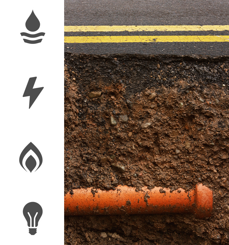
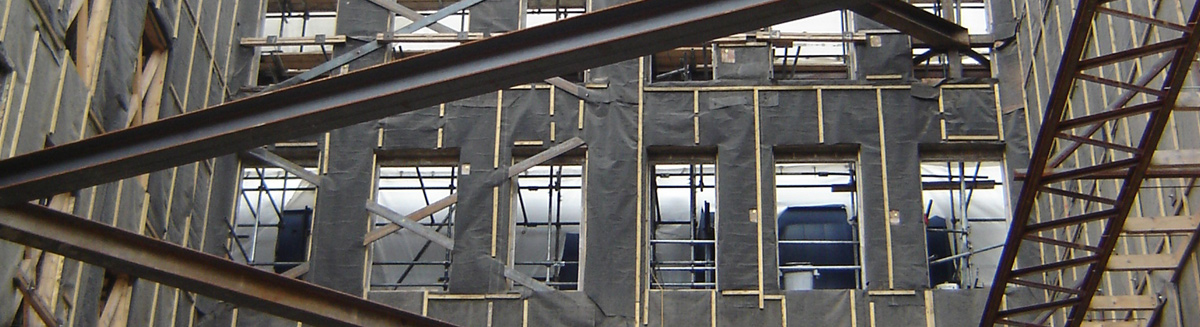
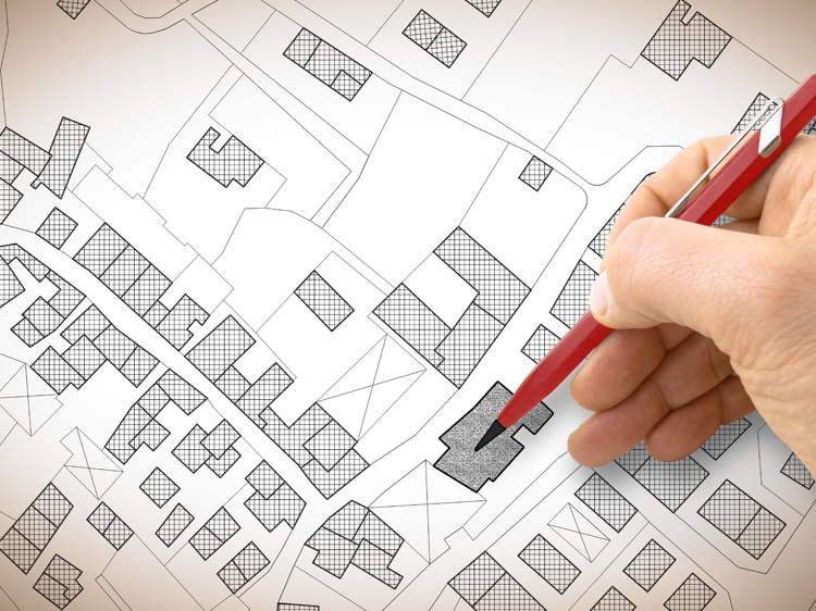
Utility Surveys
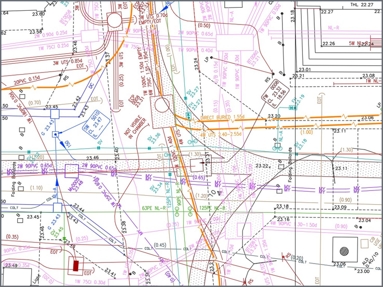
Utility Surveys BSI PAS 128:2014
Aworth Survey Consultants provides a number of utility surveying services including desktop mapping, drainage surveys, underground services tracing and CCTV drainage surveys.
Using our desktop mapping service, we can collate all the utility companies’ statutory records local to your site, and supply these as additional layers of information within a topographical survey.
A survey on existing site drainage can be undertaken to confirm connectivity, cover level and inverts. Drainage pipe flow, sizes and type are recorded and added to the topographical survey.
Underground services tracing using Radiodetection and Ground Penetrating Radar (GPR) methods can be provided to locate all underground utility services.
Aworth Survey Consultants can facilitate CCTV drainage surveys, using sophisticated CCTV survey equipment which are published on DVD, together with a full technical survey report.
We deliver BSI PAS 128:2014 compliant underground utility surveys - category types A-D based upon your specifications and requirements.
The BSI PAS 128:2014 standard provides a robust methodology for delivering utility surveys in the UK, and focuses on levels of accuracy – referred to as Survey Category Types – that you can specify when requiring a PAS 128 compliant underground utility survey.
Your project will benefit from a utility survey by having accurate data at the design and planning stage, resulting in minimised unnecessary excavation, reduced risk of damage to buried apparatus and improved work safety.
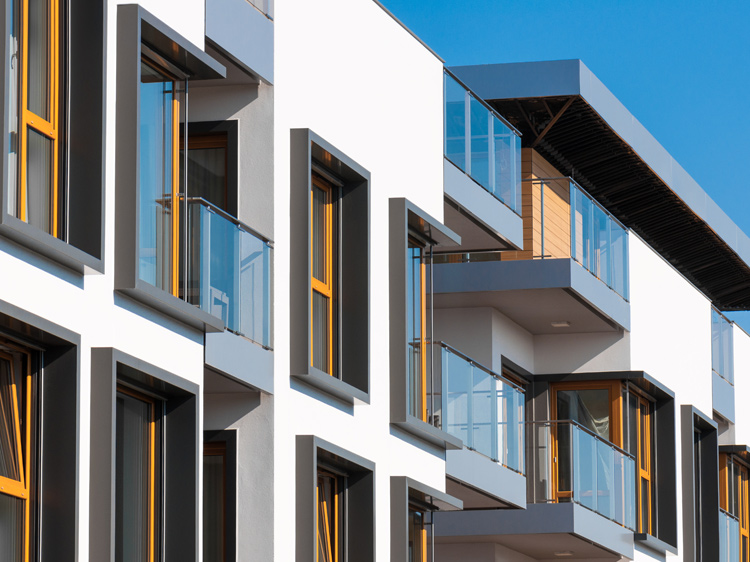
Topographical Survey
Topographical Survey
Topographical surveys, also known as topo surveys, site surveys or land surveys, provide accurate detailed mapping of all natural and man-made features. The Aworth topographical survey is provided to your specific requirements.
Aworth's survey experts provide accurate topo survey data tailored for your project design requirements. The survey information can include precise mapping and levels of infrastructure, buildings, trees, water features, boundaries and contours.
The topographical survey data can be supplied in 2D or 3D together with ground models to inform accurate design needs.
Our Aworth topographical survey specification is in accordance with RICS professional guidance, global: Measured surveys of land, buildings and utilities, 3rd edition.
All Aworth topo survey CAD data is fully layered with drawings presented to the highest standard of drafting.
Surface modelling is supplied as fully edited TIN, point or string model data in a range of formats for direct import into industry standard 3D ground modelling softwares such as Revit, PDS, Bentley and Civil 3D.
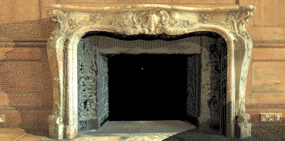
Rectified Photography
Rectified Photography
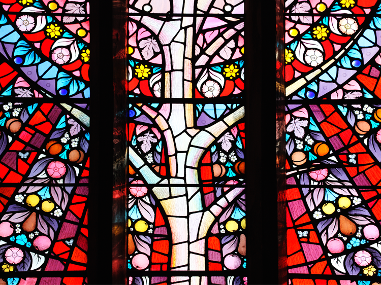
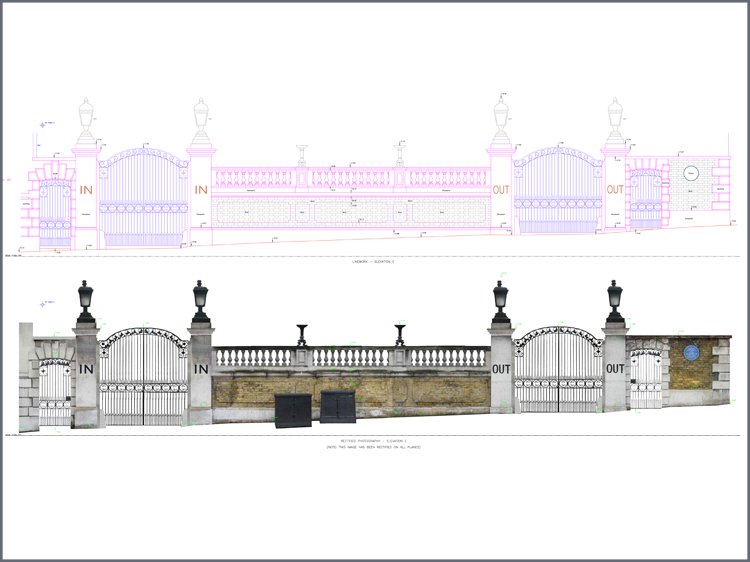
Rectified photography provides an extra level of detail to a survey, especially on heritage projects where detail such as ceilings, irregular stonework, mosaic floors, stained glass windows or building façades may need to be recorded.
The cost of producing rectified photography is relatively low compared with other aspects of building conservation work and can provide a to scale, distortion free photographic record (upon the rectified plane) which can be referenced and integrated with the linework CAD drawings.
This specialised digital photography service is incredibly effective on mosaic floors and stained-glass windows prior to renovation, where a colour record gives accurately recorded shapes a further dimension.
A detailed rectified photography record of brick, stone or mathematical tiles of building façades, walls or structure elements can provide the whole conservation and design team with accurate information to assess, programme and cost for restoration repairs.
Aworth Survey Consultants understands the special considerations and techniques required to undertake historic building surveys compliant with English Heritage specification guidelines and to meet your detailed requirements. Our vast experience in this field has allowed us to work on many fine period and listed properties including; barns, castles, churches, priories, mansions, and university buildings.
Monitoring Surveys
Monitoring Surveys
Our expertise in deformation or movement monitoring is extensive, with past projects including maritime heritage ship The Cutty Sark, loading towers at Tilbury Docks, Network Rail civil assets and structures and refurbishment/construction projects whilst under redevelopment including One Crown Place, London.
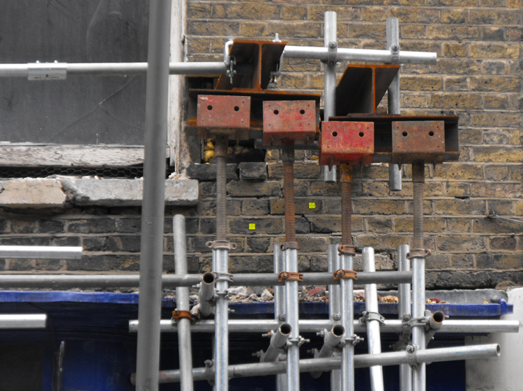
With buildings and structures on or near construction sites or excavation works susceptible to settlement or excess movement, deformation surveys measure the rate of this displacement.
Detailed measurements of civil and mechanical structures can be provided using high-order instrumentation and advanced surveying techniques to achieve ultra-precise measurement tolerances.
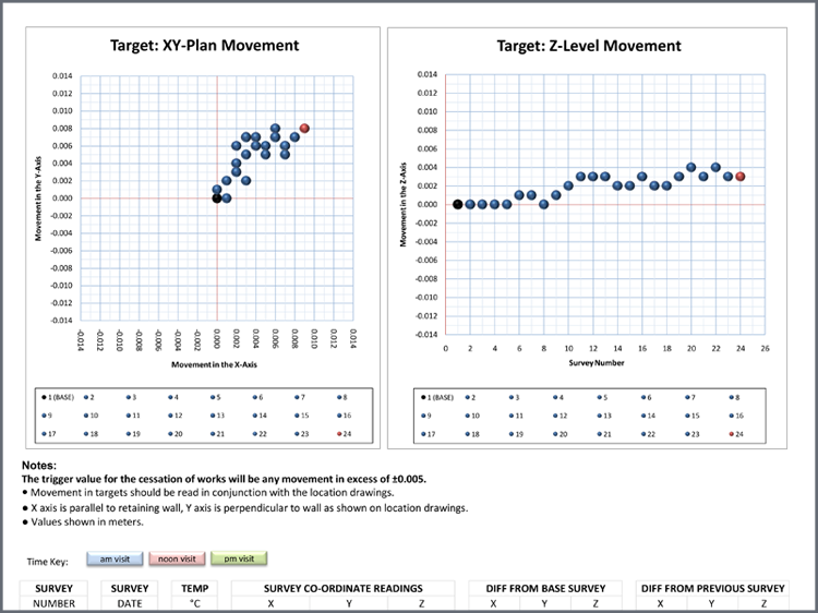
Monitoring results can be presented in spreadsheet form with graphic charts to easily demonstrate if any movement or deformation has occurred.
In addition to our standard output using fixed targets, we can also produce vertical contouring of elevational façades to identify any deformation.
This presentation of results is extremely useful to monitor progress of demolition works or to confirm precise vertical tolerances for new steel frames.
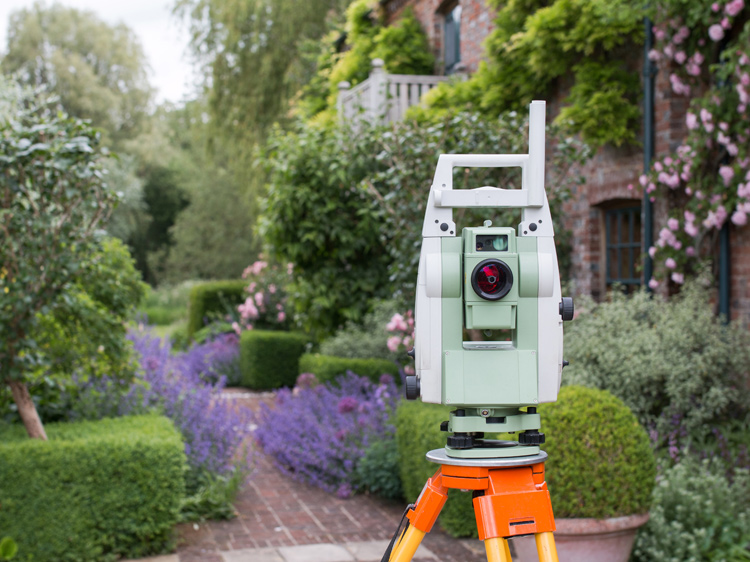
All our monitoring surveys are undertaken by our dedicated field survey teams, equipped with the latest Leica Total Stations and associated surveying equipment.
Dedicated field survey teams are accredited to undertake surveying on London Underground and Network Rail, as well as National Grid installations and confined space environments.
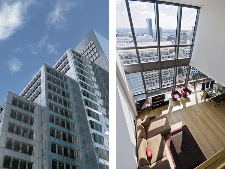
Lettable Area Calculations
Lettable Area Calculations
Area calculations may be required for valuation, management, conveyancing, planning, taxation, sale, letting or acquisition purposes.
We are fully conversant with the latest RICS Property Measurement, 2nd edition requirements and can advise you on all elements of the latest International Property Measurement Standards IPMS: Office Buildings (Parts 1, 2 and 3), IPMS: Residential Buildings (Parts 1, 2 and 3, 3a ,3b, and 3c) and the RICS Code of Measuring Practice, 6th edition.
Whether you require Code of Measuring Practice: GEA, GIA or NIA or the IPMS equivalent: Parts 1, 2 or 3, we can provide comprehensive scale drawings detailing the demise and area calculations to comply with the required standard.
Our services are often used by large corporates wanting to calculate areas for departmental demise reviews,shop unit calculations at retail centres and as-built office demises for handovers.
We pride ourselves in providing lettable area surveys on clear accurate floor plans showing the precise NIA, GIA or GEA demise areas. We annotate all deductions, together with a comprehensive schedule of the area calculations.
Gross External Area (GEA) is the area of building measured externally at each level and is primarily used for planning applications or for rating and insurance purposes to residential properties. IPMS 1: Offices/Residential (IPMS 3A) equates closely to the former GEA.
Gross Internal Area (GIA) is the area of a building measured to the internal face of the perimeter walls at each floor level. It is primarily used for calculating building costs, and for rating and service charge apportionment in the commercial sector. IPMS 2: Offices/Residential (IPMS 3B) equates closely to the former GIA.
Net Internal Area (NIA) is the usable area within a building measured to the internal face of the perimeter walls at each floor level, with specific exclusions. It is primarily used as the basis of measurement for valuation, marketing and property rating. IPMS 3: Offices/Residential equates closely to the former NIA.
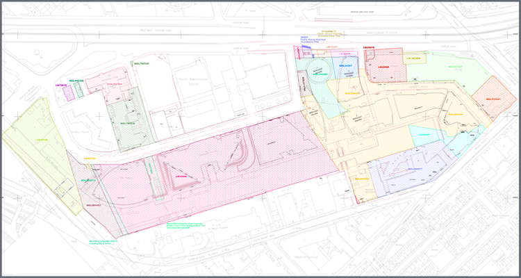
Legal Mapping
Legal Mapping
Aworth Survey Consultants has considerable experience in providing professional, impartial advice and assistance on boundary demarcation matters and Land Registry titles.
Whether there is a dispute or uncertainty on hedge boundaries or a new fence position, extent of land ownership, rights of way or rights of access, an early appointment by individuals, or with intermediaries, such as a solicitor, property developer or land agent, can assist in bringing about a speedier and more costeffective resolution to the issue.
The independent advice and assistance of professional land surveyors is invaluable in providing impartial survey reports identifying the difference between the physical boundaries and the legal boundaries that exist in deeds and Land Registry documents.
If required, Aworth Survey Consultants can provide expert witness reports in accordance with CPR Part 35 to assist in mediation or litigation processes, to aid in the resolution of boundary disputes.
For new boundaries we can produce suitable plans and any necessary fieldwork to aid your application to Land Registry to register new property and titles.
Aworth has a wealth of experience and knowledge in mapping and compiling complex Land Registry titles, which is particularly valuable with projects that have a multitude of Land Registry titles.
We can produce clear and precise defined Land Registry compliant drawings showing individual freeholds, leaseholds, underleases and compiled masterplans.
As an official supplier of Ordnance Survey maps and digital data, we can also provide Ordnance Survey data direct, if required.

Laser Scanning
Laser Scanning
Architects, designers and engineers often require far more than just a 2D survey drawing to fulfil their building’s Lifecycle Management. Aworth Survey Consultants offers the complete BIM compliant survey service, tailored to our clients’ specific requirements.
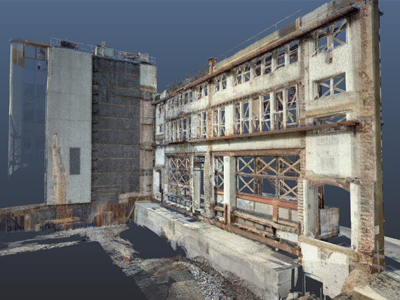
If you need to take your project beyond AutoCAD 2D plans and drawings, Aworth Survey Consultants can provide data from 3D Laser Scanning and supply 3D point cloud data and Autodesk Revit modelling outputs to take your refurbishment, redevelopment or conservation project to the next level.
3D Laser Scanning is revolutionising digital data capture for 3D use. Across all industries 3D is becoming more common for design, presentation and engineering. Laser Scanning allows the real world environment to be captured in 3D exactly as it is.
The scanning process creates a point cloud made up of millions of dimensionally accurate 3D points. Colour in the form of an RGB value is also captured.
The point cloud can then be reconstructed to give it a surface and rendered with colour or images added to give a realistic texture to the 3D model. In addition, fly-through models can also be produced.
You can view, measure or mark-up rich, laser scan point clouds with the free Leica TruView local viewer, Autodesk ReCAP or in the Revit or AutoCAD environments.
Aworth Survey Consultants offers Autodesk Revit modelling to take your refurbishment, redevelopment or conservation project to the next level. If you are working towards a Level 2 BIM workflow a Revit model is a good start to a refurbishment or alteration project.
Aworth use the same core values to build accurate Revit models from pointcloud, total station data and hand measurement. We can also convert existing 2D AutoCAD projects into Revit.
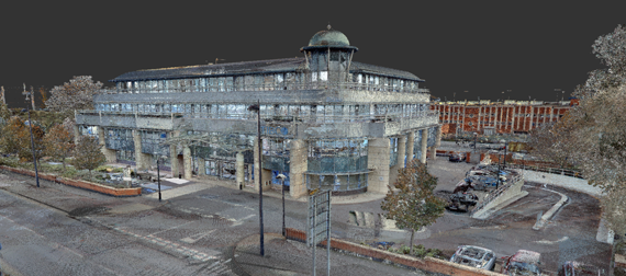
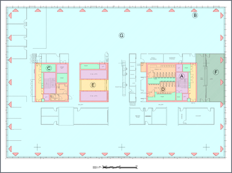
Measured Building Surveys
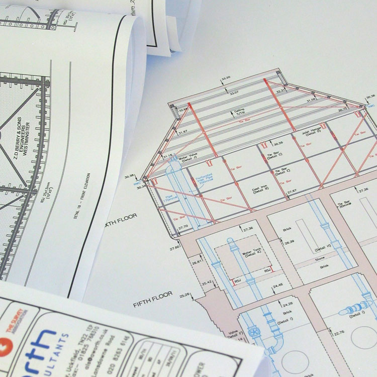
Measured Building Surveys
Aworth Survey Consultants measure buildings for refurbishment, redevelopment, conservation projects or property portfolios using the latest electronic survey instrumentation and meticulous hand measurement.
These methods allow our surveyors to produce survey drawings using site dimensions maintaining 1:1 accuracy and precise correlation between drawings in 2D AutoCAD or 3D Revit for BIM modelling.
Our standard measured building surveys are carried out in accordance with the RICS professional guidance, global: Measured Surveys of Land, Buildings and Utilities, 3rd edition.
Comprehensive measured plans define all walls, beams, stairs, columns, lifts, service entry points, kitchen and sanitary fittings, windows and doors.
Vertical information is produced for all floor levels, floor to ceiling heights, beam heights, window heights and roof levels.
Additional requirements such as lighting, service outlets, ducting, radiators and sprinkler systems can also be included.
In addition to providing measured floor plans tailored to our clients’ specific requirements, and delivered to the highest standard of drafting, we can produce reflected ceiling plans, roof plans, elevations and sections.
Whether you require RICS professional guidance, UK: Rights of Light, 2nd edition compliant elevations, standard detailed elevations or highly detailed elevations compliant with English Heritage guidelines we can produce these to meet your detailed requirements.
We can provide basic cross sections through a site, standard building sections cut through your building or highly detailed elevational sections.
Elevations and sections are prepared with reference to measured plan data to ensure accuracy and completeness.
Aworth Survey Consultants understand the special considerations and techniques required to undertake historic building surveys compliant with English Heritage specification guidelines and to meet your detailed requirements. Our experience in this field has allowed us to work on many fine period and listed properties including; barns, castles, churches, priories, mansions, and university buildings.

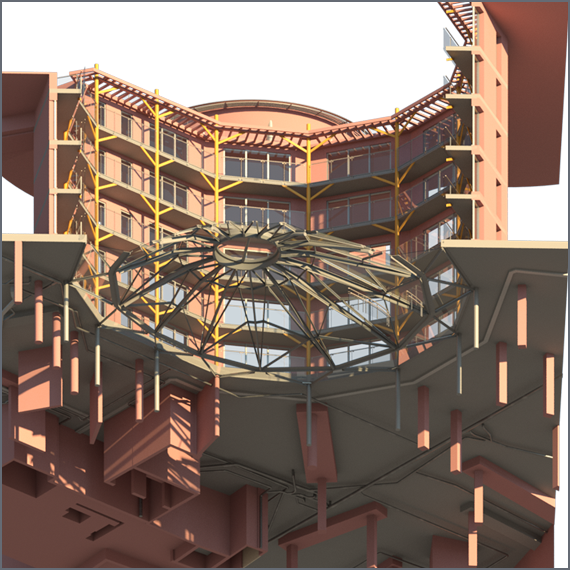
BIM
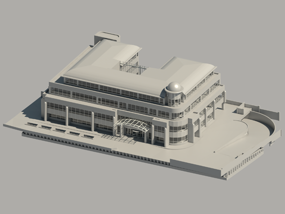
BIM & Revit Modelling
Aworth has been producing BIM models for over 30 years, beginning with land surveys developed in PDS for BIM Infrastructure Design.
Today, BIM (Building Information Modelling) is an intelligent 3D model-based process that gives architecture, engineering, and construction (AEC) professionals the insight and tools to more efficiently plan, design, construct and manage buildings and infrastructure.
Aworth Survey Consultants can provide Autodesk Revit modelling to take your refurbishment, redevelopment or conservation project to the next level. If you are working towards a Level 2 BIM workflow, a Revit model is a good start to a refurbishment or alteration project, and we can supplement the model with 3D point cloud data produced from a 3D Laser Scanner.
Revit and its powerful tools let you use the intelligent model-based process to progress from conceptual design to construction documentation within a single software environment. It allows you to optimise building performance and evaluate how well they conform to building and safety regulations. Revit supports a multi-discipline design process for collaborative design.
Aworth use the same core values to build accurate Revit models from pointcloud, Total Station data and hand measurement. We can also convert existing 2D AutoCAD projects into Revit.
All Aworth models contain custom Revit 'families' to accurately show existing building elements.
Aworth Survey Consultants can provide the complete BIM compliant survey service, tailored to our specific clients’ requirements and fulfil their Building’s Lifecycle Management and BSI standards for Building Information Modelling BS EN ISO 19650-1 and BS EN ISO19650-2.
Head Office
Norfolk House, Norfolk Way,
Uckfield, East Sussex TN22 1EP
T: 01825 768 319
London Office
The Lansdowne Building,
2 Landsdowne Road, Croydon CR9 2ER
Newsletter
Subscribe to our mailing list to keep in touch with all the latest news or follow us on:


![]()

© 2019 Aworth Survey Consultants. All rights reserved.
Site by: NWD