Utility Surveys
Utility Surveys BSI PAS 128:2014
Aworth Survey Consultants provides a number of utility surveying services including desktop mapping, drainage surveys, underground services tracing and CCTV drainage surveys.
Using our desktop mapping service, we can collate all the utility companies’ statutory records local to your site, and supply these as additional layers of information within a topographical survey.
A survey on existing site drainage can be undertaken to confirm connectivity, cover level and inverts. Drainage pipe flow, sizes and type are recorded and added to the topographical survey.
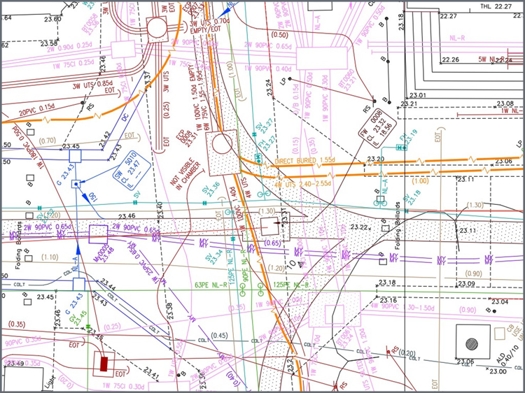
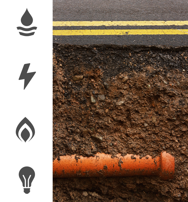
Underground services tracing using Radiodetection and Ground Penetrating Radar (GPR) methods can be provided to locate all underground utility services.
Aworth Survey Consultants can facilitate CCTV drainage surveys, using sophisticated CCTV survey equipment which are published on DVD, together with a full technical survey report.
We deliver BSI PAS 128:2014 compliant underground utility surveys - category types A-D based upon your specifications and requirements.
The BSI PAS 128:2014 standard provides a robust methodology for delivering utility surveys in the UK, and focuses on levels of accuracy – referred to as Survey Category Types – that you can specify when requiring a PAS 128 compliant underground utility survey.
Your project will benefit from a utility survey by having accurate data at the design and planning stage, resulting in minimised unnecessary excavation, reduced risk of damage to buried apparatus and improved work safety.
Head Office
Norfolk House, Norfolk Way,
Uckfield, East Sussex TN22 1EP
T: 01825 768 319
London Office
The Lansdowne Building,
2 Landsdowne Road, Croydon CR9 2ER
Newsletter
Subscribe to our mailing list to keep in touch with all the latest news or follow us on:

![]()

© 2026 Aworth Survey Consultants. All rights reserved.
Site by: Networld Design